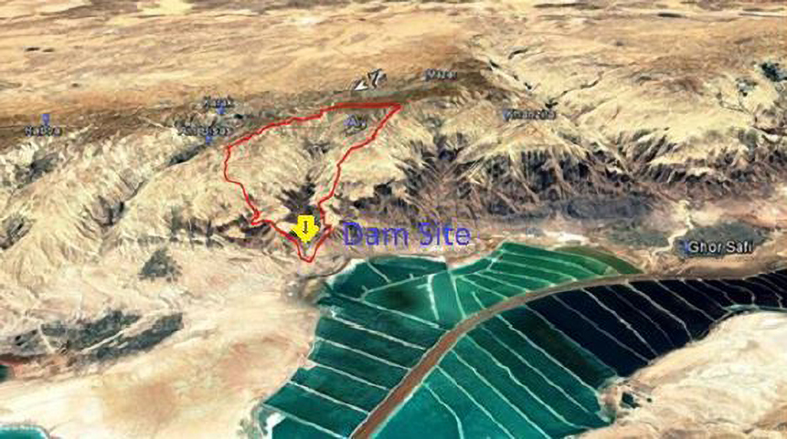
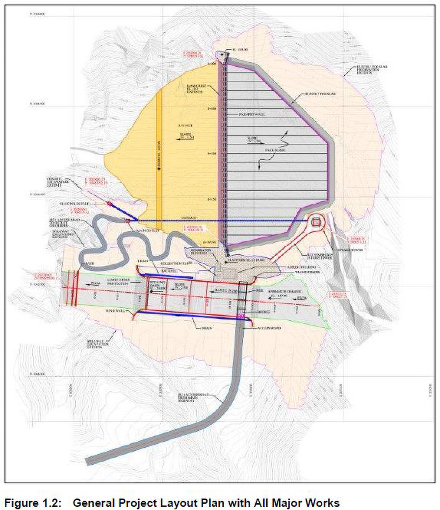
- Services Feasibility Study and Design is being conducted for proposed dam at Wadi Easal on behalf of the Jordan Valley Authority to determine the feasibility of dam & reservoir construction at Wadi Easal, at the southern tip of the Dead Sea. The services provided in this project included the following: • The Environmental & Social Impact Assessment is completed. • Geological, hydrological & hydro geological studies are undertaken. • Preliminary dam design and financial feasibility of options for dam location and capacity are undertaken. • Full, detailed design of preferred proposal including preparation of construction tender documents.
- Client Ministry of Water and Irrigation Jordan Valley Authority
- Location Near Wadi Numayra, Al-Karak
Wadi Easal is located 3 km north Wadi Numayra, the purpose of the project is to provide water for irrigation and industrial purposes, flood protection, recharge, area development and environmental restoration. The consultancy services for the project consist of two distinct phases to make a clear decision on the project formulation. Phase (A) which is entirely devoted to prepare technical, economic, environmental and financial feasibility studies and preliminary design report for the construction of Wadi Easal Dam which aims to provide JVA with environmental, topographical, hydrological and geotechnical studies. Phase (B) comprises the preparation of the final design report, final tender documents and final drawings for the dam construction. Wadi Easal is a CFRD (concrete face rockfill dam) with a maximum height of 77 m and the catchment area draining to it is 62.71 km2. The annual runoff is 3.15 MCM which includes the base-flow. The sedimentations in the reservoir are estimated in order to find out the life span of the dam for the 1st 50% of its capacity which is more than 55 years and more than 118 years for the full capacity. The dead storage of the dam is estimated to be filled with sediments in 30 years operation assuming that there will be no flushing/sluicing of the reservoir. The spillway is designed for 1000 years peak flood of 230.6 m3/s with a peak flood released from the spillway with a surcharge head of 2.2 m with outflow of 229 m3/s. the sediment yield from the catchment is 41,347 ton/year.


