- Services Design services for Jeddah wastewater networks including adding sensors to the network in order to establish a monitoring system for the network. The scope of works under this project included: 1. Preparation of tender documents including: • General and Special conditions of contract • Specifications for equipment and works • Design of the system (including drawings) • Bill of Quantities 2. Develop an institutional development plan and training programme for local operatives involved in the operation and maintenance of the system.
- Value of Construction: 11,160,000 JD
- Client Client of MSQ: Environmental Studies and Consultations Office " ESCO" Client of ESCO: National Water Company
- Location Jeddah
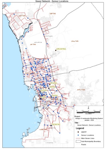
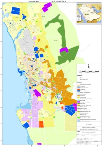
The objective of this project is to design a monitoring system for the wastewater collection network of Jeddah, KSA. The system will allow continuous monitoring of the network for wastewater levels and the presence of identified pollutants discharged into the system. Such monitoring allows warning of substances which may affect the operation of the wastewater treatment plants entering the network and localize the probable source of the pollutant. A secondary sampling regime was also specified in order to identify the exact source of the pollution for further action to prevent recurrence. In order to prepare relevant information to allow the assessment of risk of pollution events caused by discharge of prohibited substances, mapping of the official land use master plan for Jeddah was prepared in a GIS system. Industrial areas were identified and surveyed to identify the type of operations at each facility. Identified buildings which may present pollution risks in other areas were also identified as far as is practicable. Identified facilities were assessed for risk of causing significant pollution events and categorized per the degree of risk which is represented. This information is stored within a database and represented as separate layers within the GIS system. The available wastewater network drawings are added to the GIS system and the optimum locations for monitoring and sampling are identified according to the type of pollutant(s) possible and the concentration of facilities connected to the network in each area. For high risk properties, sampling points are identified which would allow the exact source of any pollution to be confirmed.


